International Charter: Space and Major Disasters
When disaster strikes, 17 space agencies and satellite operators pool their satellites and give free images to rescuers; activated 1,000 times in 146 countries (International Charter).
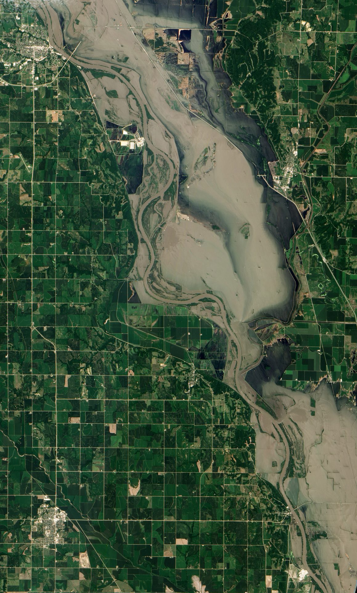
Image: NASA Earth Observatory (EO-1 ALI, July 17, 2011).
Last reviewed: 8 sources cited
Explain Like I'm 10
- When a big flood or earthquake happens, rescuers need a map fast.
- Space agencies around the world agree to point their satellites at the disaster.
- They give the pictures away for free, so helpers know where people need them.
The Five W's of The Charter
Who
An international collaboration among 17 space agencies and satellite operators. The European Space Agency and France's space agency CNES started it with the Canadian Space Agency.
Source: International Charter, 1,000 activations (Nov 18, 2025)
What
A single 24/7 access point. When a disaster authority activates it, satellites are tasked and specialists turn the images into maps, free of charge to the user.
Source: International Charter, 1,000 activations (Nov 18, 2025)
When
It became operational on November 1, 2000. Its 1,000th activation came on November 3, 2025, for an earthquake in Afghanistan.
Source: International Charter, 1,000 activations (Nov 18, 2025)
Where
Anywhere in the world: it has responded to disasters in 146 countries, using a constellation of more than 270 satellites.
Source: International Charter, 1,000 activations (Nov 18, 2025)
Why
Floods, storms, landslides, wildfires and other weather-related disasters make up 79% of activations. Fast maps help rescuers decide where to go first.
Source: International Charter, 1,000 activations (Nov 18, 2025)
Impact Statement
Agency solution · active
For the 1,000th activation, 350 images from satellites tasked over the area were available in less than two days (CNES).
Source: CNES, 1,000 activations of the Charter (Dec 9, 2025, in French)
For Further Information: International Charter, 1,000 activations (Nov 18, 2025)
The Charter has been activated 1,000 times in 25 years, an average of about 40 activations a year (International Charter).
How This Saves People & the Planet
For People
Maps of flood extents and collapsed buildings help rescuers prioritise search and rescue, send resources and plan logistics (International Charter).
Source: International Charter, 1,000 activations (Nov 18, 2025)
For Nature
The Charter also covers oil spills and industrial accidents, so responders can see where pollution is spreading (International Charter).
Source: International Charter, 1,000 activations (Nov 18, 2025)
Sentinel Asia: The Asia-Pacific Partner
Sentinel Asia is a regional network in Asia and the Pacific that answers Emergency Observation Requests after disasters. Since the start of 2007 it has accepted 546 requests and activated 495 of them.
Source: Sentinel Asia, Annual Report 2024
In 2024, 68 requests came in and 64 were activated, the highest number of requests ever. Images from Japan, India, Taiwan and the United Arab Emirates helped after the January 1, 2024 earthquake in Japan.
DLR ZKI: Germany's Crisis Mapping Center
The Center for Satellite Based Crisis Information (ZKI) at the German Aerospace Center (DLR) was founded in 2004. It provides satellite data and products for the International Charter and helped develop Copernicus emergency mapping.
Source: DLR, Center for Satellite Based Crisis Information (ZKI)
ZKI has produced more than 1,500 information products since 2004. Its public archive lists 160 entries, which include exercises as well as real activations.
Source: DLR ZKI, activation archive
Get Involved With The Charter
Want to go deeper? The International Charter has the full Charter story.
For Further InformationRelated Solutions
More solutions like this one, matched by meaning.
Help This Work
This is a public mission, so there is nothing to donate. You can explore its free data or join a citizen science project.