Tsunami Early Warning (NOAA, NASA and partners)
Deep-ocean buoys, satellites, GPS signals and seafloor cables spot tsunamis in the open ocean so coastal communities get time to reach high ground (NOAA, NASA).
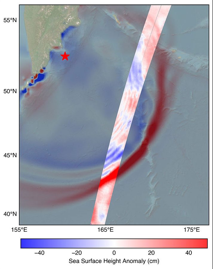
Image: NASA/JPL-Caltech (PIA26652).
Last reviewed: 16 sources cited
Important: What Warnings Can and Cannot Do
These systems are highly reliable for detecting that a tsunami is happening and roughly how big it is, but no system today can pinpoint the exact moment or exact spot a wave will hit a specific beach.
Forecasts give estimated arrival times and areas at risk. Always follow official alerts and natural warning signs.
Explain Like I'm 10
- A A series of giant ocean waves, usually caused by an undersea earthquake, volcano or landslide. Glossary is a group of giant waves, usually made when a big earthquake shakes the sea floor.
- Buoys, satellites and special computers watch the ocean and tell warning centers when a tsunami is coming.
- If the ground shakes hard or the sea pulls back fast near a beach, go to high ground right away.
The Five W's of Tsunami Early Warning
Who
NOAA runs the U.S. Tsunami Warning Centers and the DART buoy network; NASA, the French space agency CNES, and many partner agencies add new tools.
Source: NOAA National Data Buoy Center, DART description · NOAA U.S. Tsunami Warning Centers (tsunami.gov)
What
A chain of sensors that measures the ocean itself, not just the shaking ground, so forecasters can confirm a tsunami and estimate its size.
When
NOAA finished the first six DART buoys in 2001 and grew the network to 39 stations in 2008. New tools were tested in the magnitude 8.8 Kamchatka earthquake of July 29, 2025 (UTC).
Source: NOAA National Data Buoy Center, DART description · NASA, SWOT satellite measures tsunami after massive quake
Where
Mostly the Pacific Ocean, where many tsunamis start, plus the Atlantic, the Mediterranean and the Indian Ocean.
Source: NOAA National Data Buoy Center, DART description · Sonardyne, First tsunami monitoring deep-sea buoys in the Mediterranean (company case study) · BMKG, HF Radar Array Ujong Batee, Aceh
Why
A tsunami can cross an ocean at jet-plane speed. Every extra minute of warning helps people move to high ground.
Source: NASA JPL, GUARDIAN tsunami detection tech catches wave in real time
What Is a Tsunami?
A tsunami is a series of giant waves. It usually starts when a big earthquake under the sea suddenly lifts or drops the seafloor. That shoves the whole column of water, from the bottom of the ocean to the top, and waves spread out like ripples from a pebble dropped in a pond.
Source: NASA, SWOT satellite measures tsunami after massive quake
In deep water a tsunami may be only a foot or two tall, so ships barely notice it. Near the coast the water piles up, and a small open-ocean wave can become a 30-foot wave.
Source: NASA, SWOT satellite measures tsunami after massive quake
Earthquakes are the most common cause, but volcanic eruptions and underwater landslides can make tsunamis too.
Source: NASA JPL, GUARDIAN tsunami detection tech catches wave in real time
How Scientists Spot a Tsunami
DART buoys (NOAA)
A DART station has two parts: a pressure sensor anchored on the deep seafloor and a buoy floating above it. The sensor feels the weight of the water change when a tsunami passes, and it can sense a tsunami as small as about 1 cm (less than half an inch).
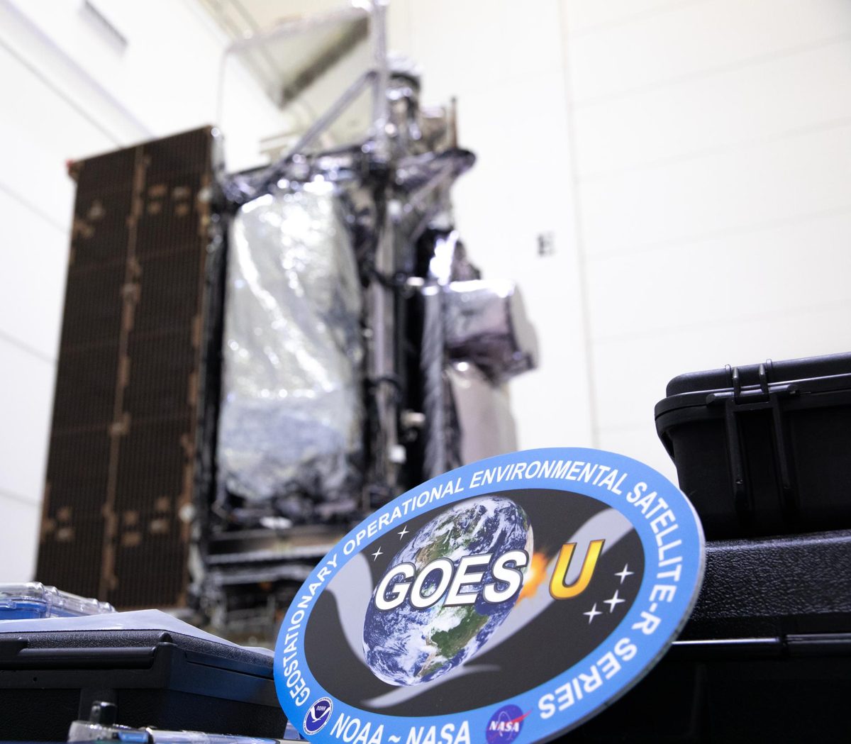
It measures every 15 seconds. When it senses an event it switches to "event mode" and sends those 15-second readings by sound to the buoy, which relays them by satellite (GOES and Iridium) to the warning centers.
Source: NOAA National Data Buoy Center, DART description · NOAA PMEL, DART mooring system
SWOT satellite (NASA and CNES)
About 70 minutes after the Kamchatka earthquake, the SWOT satellite flew over the tsunami and measured the leading edge of the wave at more than 1.5 feet (45 cm) high. Its wide A tool that sends out radio waves and listens for the echoes. From space it can see the ground through clouds, day or night. Glossary swath gave the first high-resolution, two-dimensional view of a great tsunami from space.
Scientists combined SWOT with DART buoy data. One study found the earthquake broke about 400 km of fault, longer than the roughly 300 km in earlier models. Another linked a train of short waves to slip within about 10 km of the ocean trench.
NOAA tsunami scientist Vasily Titov said: "It suggests SWOT data could significantly enhance operational tsunami forecasts."
Source: NASA, SWOT satellite measures tsunami after massive quake · Ruiz-Angulo et al., The Seismic Record (2025) · Sepúlveda et al., Science (2026)
SWOT was built to study water, not to issue warnings. Using its data in everyday tsunami forecasts is a potential solution NASA and CNES are advancing. We expect to know more within the coming years and will keep you updated here.
GUARDIAN (NASA JPL)
When a tsunami lifts a huge patch of ocean, it pushes the air up and sends waves all the way to the A high layer of the atmosphere, about 50 to 600 miles up, full of electrically charged particles. Glossary, high above Earth. Those waves slightly bend GPS and other navigation signals. GUARDIAN uses SI (artificial intelligence) to look for these clues in data from more than 350 ground stations around the world, and can sense a tsunami up to about 1,200 km (745 miles) from a station.
During the Kamchatka event it sent notices to experts in as little as 20 minutes after the quake and confirmed signs of the tsunami about 30 to 40 minutes before waves reached Hawaii. It estimated the wave speed near the coast at over 580 miles per hour (260 meters per second).
NOAA Center for Tsunami Research director Christopher Moore said it "provides one more piece of information, one more valuable data point, that can help us determine, yes, we need to make the call to evacuate." A machine-learning helper called GUARDIAN Scout flags possible signals after magnitude 6.5 or larger earthquakes.
Source: NASA JPL, GUARDIAN tsunami detection tech catches wave in real time · NASA JPL, About GUARDIAN and GUARDIAN Scout
GUARDIAN is experimental and its outputs must be checked by trained experts; GUARDIAN Scout is a research tool and is not a warning system. This is a potential solution NASA JPL is advancing. We expect to know more within the coming years and will keep you updated here.
Visit GUARDIAN (guardian.jpl.nasa.gov)
Listening through seafloor cables
Internet cables already cross the oceans. Researchers turned a 4,400 km telecom cable in the Pacific into about 44,000 sensors spaced 100 meters apart. It recorded the magnitude 8.8 earthquake and, in a first, a tsunami wave in the deep ocean about 1,000 km offshore.
On October 5, 2026, Pacific tsunami leaders meeting in Honolulu discussed SMART cables (cables with built-in sensors) and asked for more testing before warning centers rely on them.
Source: Mazur et al., submarine cable observation of the M8.8 earthquake and tsunami (arXiv preprint) · UNESCO, Pacific tsunami leaders meet in Honolulu
The cable study is a preprint, and cable sensing is not yet used for official warnings. This is a potential solution researchers and warning centers are advancing. We expect to know more within the coming years and will keep you updated here.
First deep-sea tsunami buoys in the Mediterranean
Italy's national geophysics institute (INGV) installed the first two tsunami detection buoys in the Mediterranean, in the Ionian Sea: one off Sicily at 3,200 m deep and one off Calabria at 2,600 m, each about 100 km from the coast. Each pairs a Sonardyne seafloor pressure recorder with a surface buoy.
Source: Sonardyne, First tsunami monitoring deep-sea buoys in the Mediterranean (company case study)
Coastal radar in Indonesia
On October 8, 2026, Indonesia's weather and geophysics agency BMKG opened a high-frequency (HF) radar array at Ujong Batee, Aceh. It watches surface currents and waves up to 150 km out and can switch to a tsunami mode, adding one more data source to tsunami early warning.
Source: BMKG, HF Radar Array Ujong Batee, Aceh
Seafloor GPS on the Cascadia fault (USGS)
Between 2021 and 2025 the USGS installed four GNSS-A seafloor sites off the southern end of the Cascadia A place where one of Earth's plates slides under another. The biggest earthquakes and tsunamis start here. Glossary, off the U.S. Pacific Northwest. They track how the plates move and where stress builds, which helps scientists understand future earthquake and tsunami hazards.
Source: Sonardyne, Monitoring the restless Earth (USGS GNSS-A case study)
Sea-level satellites
Satellites such as Sentinel-6 keep a long record of sea-surface height, the same kind of measurement SWOT uses to see tsunami waves.
Source: ESA, Copernicus Sentinel-6
Explore: SWOT · Sentinel-6B · DSCOVR / EPIC · Earth Observation
How to Stay Safe
There are two kinds of tsunami warnings, official and natural. Act on whichever comes first.
Natural warnings: a strong or long earthquake, the ocean suddenly rising fast or draining away like a very low tide, or a loud roar from the ocean. If you are near the coast, do not wait for an official alert. Move to high ground or as far inland as you can.
Official warnings come from NOAA, local radio and TV, or your phone. Stay away from beaches, follow evacuation signs, and always follow instructions from local officials. The first wave may not be the last or the largest.
Source: NOAA National Weather Service, Tsunami safety: during a tsunami · NOAA U.S. Tsunami Warning Centers (tsunami.gov)
Impact Statement
Agency solution · active (some tools on the horizon)
DART buoys confirm tsunamis in the open ocean, and new tools such as SWOT and GUARDIAN helped scientists track the 2025 Kamchatka tsunami across the Pacific in close to real time.
Source: NOAA National Data Buoy Center, DART description · NASA, SWOT satellite measures tsunami after massive quake · NASA JPL, GUARDIAN tsunami detection tech catches wave in real time
For Further Information: NOAA U.S. Tsunami Warning Centers
About 70 minutes after the 2025 Kamchatka earthquake, the SWOT satellite measured the tsunami from space: a wave more than 1.5 feet high racing across the Pacific.
How This Saves People & the Planet
For People
Warnings give coastal towns time to evacuate low-lying areas. NASA JPL says that in ideal cases, communities near a GNSS station could have as much as 1 hour and 20 minutes to evacuate.
Source: NASA JPL, GUARDIAN tsunami detection tech catches wave in real time
For Nature
The same ocean data helps scientists understand how tsunamis grow and strike, which supports planning for coastal places where wetlands, beaches and reefs meet the sea. Satellites like SWOT also keep watching the ocean surface that marine life depends on.
Source: NASA, SWOT satellite measures tsunami after massive quake · Ruiz-Angulo et al., The Seismic Record (2025)
Want to go deeper? NOAA's Tsunami Warning Centers post live alerts and safety tips.
 For Further Information
Related Solutions
More solutions like this one, matched by meaning.