Global Flood Awareness System (GloFAS)
Free global river flood forecasts up to 30 days ahead, plus 4-month outlooks, from the Copernicus Emergency Management Service (CEMS).
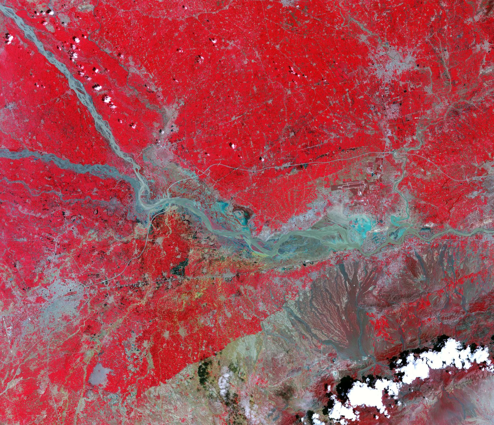
Image: NASA Earth Observatory (ASTER on Terra, Aug. 4, 2010).
Last reviewed: 4 sources cited
Explain Like I'm 10
- GloFAS predicts when rivers might flood, up to a month ahead.
- It uses weather forecasts and computer models of rivers.
- Early warnings give families time to move to safety.
The Five W's of GloFAS
Who
The Copernicus Emergency Management Service (CEMS), part of the EU's Copernicus programme.
Source: CEMS Floods, Monitoring and reporting floods worldwide (March 2024)
What
Free and open hydrological predictions: river flood forecasts up to 30 days ahead and outlooks up to 4 months.
Source: CEMS Floods, Monitoring and reporting floods worldwide (March 2024)
When
Running now; a March 2024 report counted 5,373 registered users.
Source: CEMS Floods, Monitoring and reporting floods worldwide (March 2024)
Where
Worldwide, giving a global overview that adds to national and regional forecasts.
Source: CEMS Floods, Monitoring and reporting floods worldwide (March 2024)
Why
A global overview of floods helps disaster management when international aid is needed.
Source: CEMS Floods, Monitoring and reporting floods worldwide (March 2024)
Impact Statement
Agency solution · active
GloFAS gives free flood forecasts up to 30 days ahead to 5,373 registered users, and supports the EU's Emergency Response Coordination Centre (CEMS, March 2024).
Source: CEMS Floods, Monitoring and reporting floods worldwide (March 2024)
For Further Information: CEMS Floods, Monitoring and reporting floods worldwide (March 2024)
GloFAS river forecasts reach up to 30 days ahead, with seasonal outlooks up to 4 months (CEMS).
How This Saves People & the Planet
For People
GloFAS gives national and regional authorities extra information to prepare for floods (CEMS).
Source: CEMS Floods, Monitoring and reporting floods worldwide (March 2024)
For Nature
GloFAS analyses compare river discharge and flood events worldwide, a picture of how rivers are behaving (CEMS).
Source: CEMS Floods, Monitoring and reporting floods worldwide (March 2024)
Get Involved With GloFAS
Want to go deeper? Copernicus EMS has the full GloFAS story.
For Further InformationRelated Solutions
More solutions like this one, matched by meaning.

Help This Work
This is a public mission, so there is nothing to donate. You can explore its free data or join a citizen science project.