European Forest Fire Information System (EFFIS)
Europe's wildfire system forecasts fire danger and maps burnt areas from satellites; in 2024 it mapped fires in 42 countries (EFFIS).
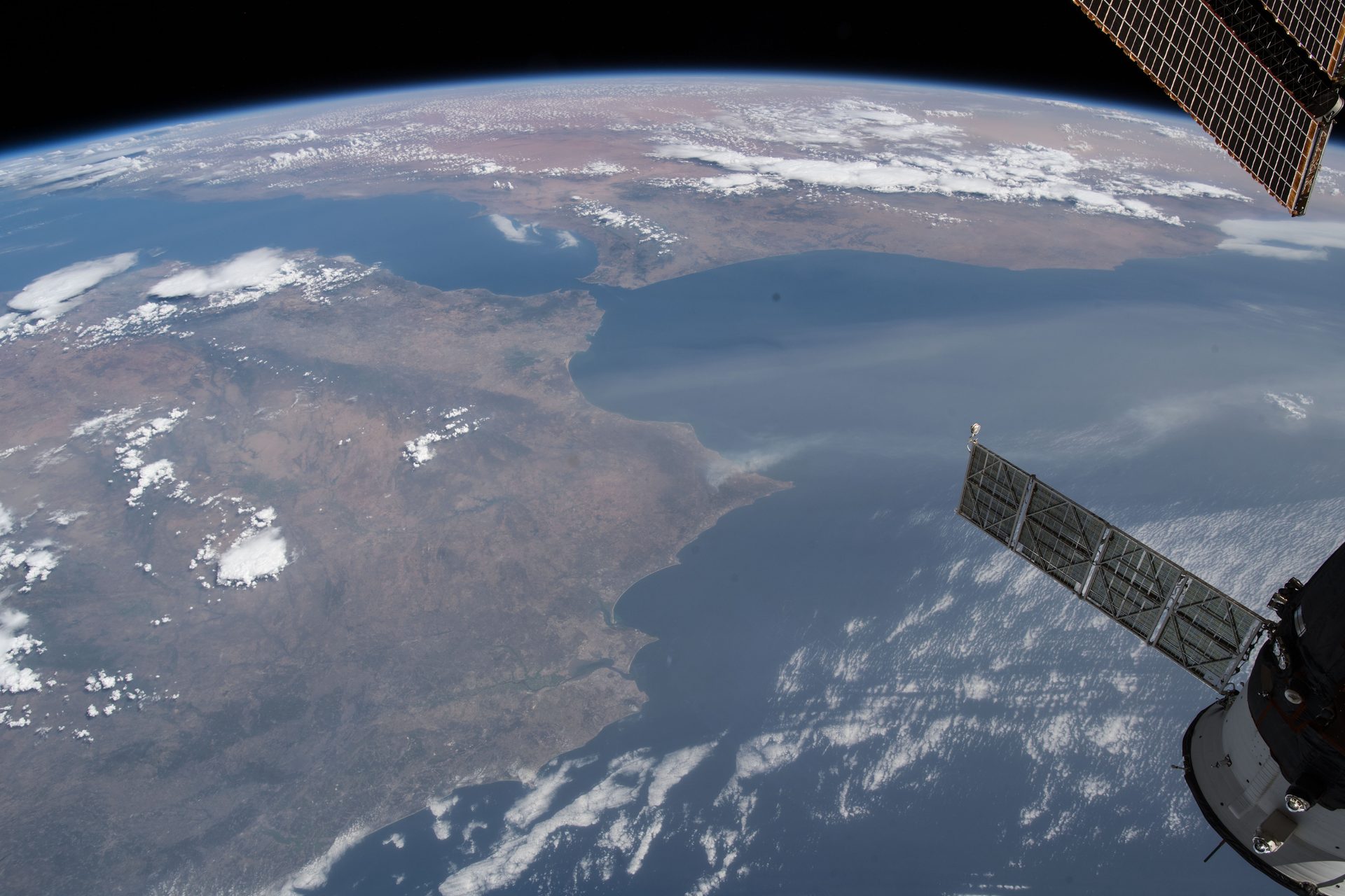
Image: NASA (ISS056-E-127068, Aug. 6, 2018).
Last reviewed: 6 sources cited
Explain Like I'm 10
- EFFIS warns when the weather makes forest fires likely.
- After a fire, satellites show exactly how much land burned.
- Countries use this to fight fires and plan how forests recover.
The Five W's of EFFIS
Who
The European Commission's Joint Research Centre with European countries. Since 2015 EFFIS has been part of the EU Copernicus Emergency Management Service.
Source: EFFIS, Brief history
What
Fire danger forecasts, active fire detection and rapid satellite mapping of burnt areas, using MODIS, VIIRS and Sentinel-2 images.
Source: EFFIS, Rapid Damage Assessment
When
EFFIS became operational in 2000. Rapid damage mapping began in 2003.
Source: EFFIS, Brief history
Where
Europe, the Middle East and North Africa; in 2024 fires were mapped in 42 countries.
Source: JRC, Advance report on forest fires in Europe, Middle East and North Africa 2024
Why
Wildfires threaten lives, homes and forests. Fast maps help countries respond and plan recovery.
Source: EFFIS, Rapid Damage Assessment
Impact Statement
Agency solution · active
In 2024, EFFIS mapped a total burnt area of 1,866,900 hectares across 42 countries, around twice the area mapped in 2023 (JRC).
Source: JRC, Advance report on forest fires in Europe, Middle East and North Africa 2024
For Further Information: EFFIS, Brief history
Since 2018, Sentinel-2 images let EFFIS map fires under 30 hectares; it now maps about 95% of the area that burns in the EU each year (EFFIS).
How This Saves People & the Planet
For People
Daily burnt-area maps and fire danger forecasts help countries prepare for and respond to wildfires (EFFIS).
Source: EFFIS, Rapid Damage Assessment
For Nature
Mapping every burnt forest shows where A community of living things and the place they live, like a reef or a forest, all depending on each other. Glossary need recovery after fires (EFFIS).
Source: EFFIS, Rapid Damage Assessment
Get Involved With EFFIS
Want to go deeper? EFFIS has the full EFFIS story.
For Further InformationRelated Solutions
More solutions like this one, matched by meaning.

Help This Work
This is a public mission, so there is nothing to donate. You can explore its free data or join a citizen science project.