FireSat (Earth Fire Alliance)
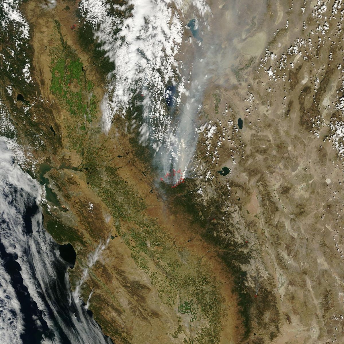
Earth Fire Alliance's FireSat satellites are built to spot wildfires as small as 5 by 5 meters from space and get the data to firefighters fast (Earth Fire Alliance).
Image: NASA (MODIS, Terra satellite).
Last reviewed: 3 sources cited
Explain Like I'm 10
- Wildfires are much easier to stop while they are still small.
- FireSat satellites carry special cameras that can sense heat from space.
- They can spot a fire about the size of two parking spaces and help firefighters act fast.
The Five W's of FireSat
Who
Earth Fire Alliance, a global nonprofit coalition, with Muon Space building the satellites. Funders include the Bezos Earth Fund, Google.org, the Gordon and Betty Moore Foundation and the Patrick J. McGovern Foundation.
Source: Earth Fire Alliance, FireSat first light (Sep 16, 2026)
What
FireSat is the first satellite constellation designed specifically for wildfires. Its A kind of light our eyes can't see that we feel as heat. Special cameras use it to see warm objects and gases. Glossary instruments can detect fires as small as 5 by 5 meters, about the size of two parking spaces, and measure how intense a fire is.
Source: Earth Fire Alliance, FireSat first light (Sep 16, 2026)
When
A test satellite launched in March 2025. The first three operational FireSats reached The curved path an object takes as it travels around a planet, moon or star, like a satellite circling Earth. Glossary on July 7, 2026, and their first images were released on September 16, 2026.
Source: Earth Fire Alliance, FireSat first light (Sep 16, 2026)
Where
In orbit around Earth. The first images covered three continents, including Dubbo in Australia, Portugal's Porto District and the Big Grass Fire on the Oregon-Idaho border in the United States.
Source: Earth Fire Alliance, FireSat first light (Sep 16, 2026)
Why
The satellites we rely on today were not built for wildfires and miss detail and timing. FireSat data should reach fire agencies at least twice a day by the end of 2026, with global access expected by 2028 and an hourly global revisit by 2029.
Source: Earth Fire Alliance, FireSat first light (Sep 16, 2026)
Impact Statement
Nonprofit solution · active
The first three FireSats watched the front of the Big Grass Fire five times over three nights and two days, showing how it moved and faded (Earth Fire Alliance).
Source: Earth Fire Alliance, FireSat first light (Sep 16, 2026)
For Further Information: Earth Fire Alliance, FireSat first light (Sep 16, 2026)
FireSat can detect a fire as small as 5 by 5 meters, about the footprint of two parking spaces.
How This Saves People & the Planet
For People
Wildfire smoke is linked to more than 1.5 million deaths a year, so earlier warnings give firefighters and communities more time to act (Earth Fire Alliance figure).
Source: Earth Fire Alliance
For Nature
FireSat can measure how hot a fire burns, which helps tell planned, managed burns apart from fires that are out of control.
Source: Earth Fire Alliance, FireSat first light (Sep 16, 2026)
Support FireSat
Support Earth Fire Alliance directly.
 Donate
Related Solutions
More solutions like this one, matched by meaning.
Help This Work
Links go straight to the organization. Saving Planets doesn't receive any of the money.