Argo Ocean Float Array
Close to 4,000 robotic floats dive through the ocean and send back temperature and salinity data, free to everyone; the 3 millionth profile came in July 2024 (Argo).
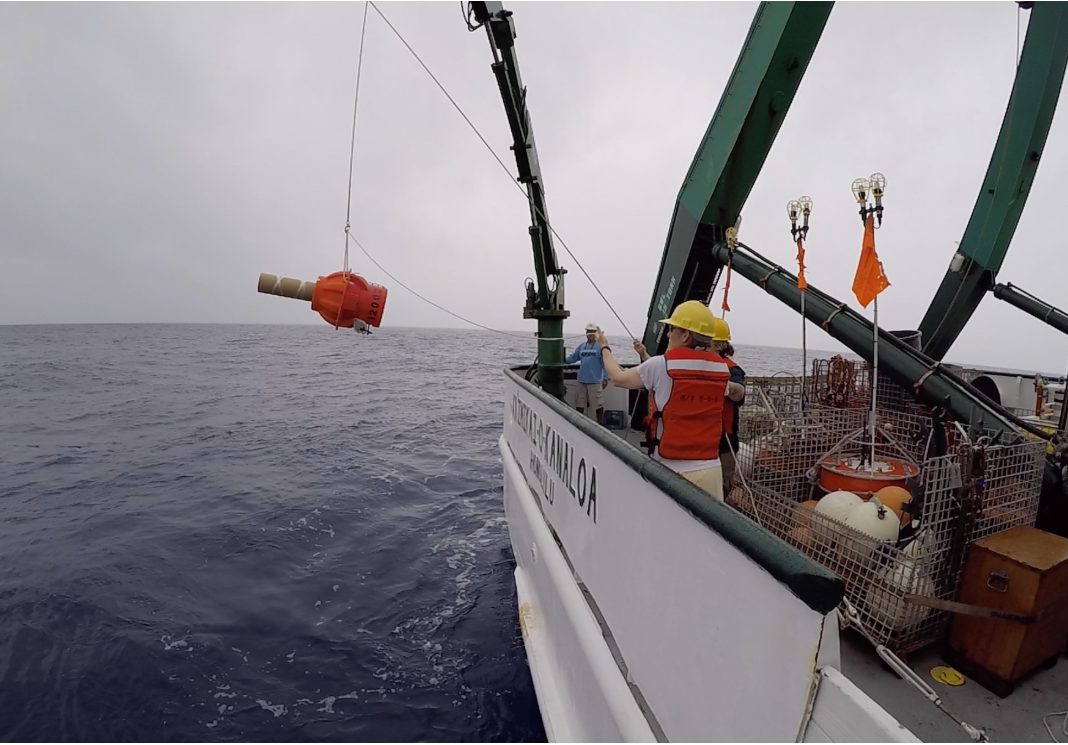
Image: NOAA (Deep SOLO float deployment from R/V Kaʻimikai-O-Kanaloa, 2018).
Last reviewed: 6 sources cited
Explain Like I'm 10
- Argo floats are robots that sink deep into the ocean and come back up.
- On the way they measure how warm and how salty the water is.
- They send the numbers to a satellite, and anyone can use them for free.
The Five W's of Argo
Who
An international program: 26 countries take part, and NOAA funds half of it.
What
Robotic floats that dive as deep as 2,000 m (Deep Argo floats go to 6,000 m) and drift for 10 days between reports, producing 100,000+ profiles a year.
Source: Argo, Frequently asked questions
When
Deployments began in 2000. The 1 millionth profile came in November 2012, the 2 millionth in November 2018 and the 3 millionth in July 2024.
Source: Argo, Implementation status
Why
Argo data improve climate and weather forecasts and help society prepare for environmental change.
Impact Statement
Agency solution · active
In 25 years Argo delivered 3 million profiles, four times the ocean information collected by all other ocean observing tools combined (NOAA).
Source: NOAA, Argo turns 25 (Dec 11, 2024)
For Further Information: NOAA, Argo turns 25 (Dec 11, 2024)
The entire Argo array uses about 120 watts, roughly 60% of the power of one gaming console (NOAA).
How This Saves People & the Planet
For People
Argo data are used in nearly 600 NOAA products, from forecasts to disaster preparedness (NOAA).
Source: NOAA, Argo turns 25 (Dec 11, 2024)
For Nature
Biogeochemical Argo floats measure ocean oxygen and acidity, which matter for the health of many marine organisms (NOAA).
Get Involved With Argo
Want to go deeper? Argo has the full Argo story.
For Further InformationRelated Solutions
More solutions like this one, matched by meaning.
Help This Work
This is a public mission, so there is nothing to donate. You can explore its free data or join a citizen science project.