OpenET Satellite Water Data
Free satellite data on how much water crops and land use, now for all 48 contiguous states; more than 13,000 registered users (OpenET figure).
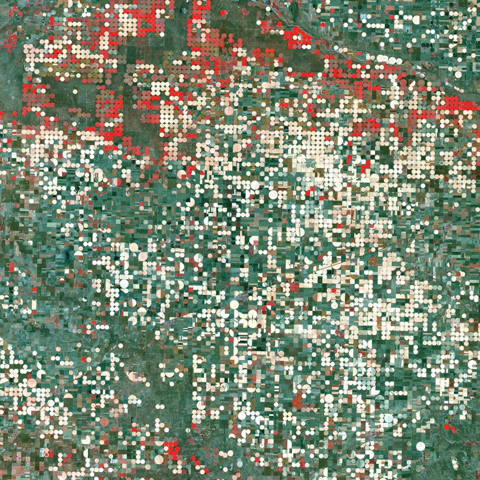
Image: NASA/GSFC/Landsat (Sept. 25, 2000).
Last reviewed: 5 sources cited
Explain Like I'm 10
- Plants drink water and breathe it out into the air.
- OpenET uses satellites to measure how much water every field uses.
- Farmers can then water only what crops need and save water.
The Five W's of OpenET
Who
OpenET, a nonprofit initiative. Its consortium partners include NASA, the U.S. Geological Survey, Environmental Defense Fund, Desert Research Institute and Google Earth Engine.
Source: NASA, Expanding crucial water tracking (Dec 16, 2025)
What
Daily and monthly Water moving from the ground into the air, partly by evaporating from soil and partly by passing through plants and out of their leaves. Glossary data, the water moving from ground to air through plants and evaporation, at a quarter acre per pixel.
When
Launched in 2021 with 17 western states, grew to 23 states in 2023 and reached all 48 contiguous states in December 2025.
Why
Better water data help with irrigation scheduling, water accounting, drought monitoring and fire risk.
Source: NASA, Expanding crucial water tracking (Dec 16, 2025)
Impact Statement
Nonprofit solution · active
OpenET has more than 13,000 registered users who retrieve data for uses from irrigation scheduling to water accounting across major river basins (OpenET figure).
Source: OpenET, Expands to 48 states (Dec 16, 2025)
For Further Information: NASA, Expanding crucial water tracking (Dec 16, 2025)
OpenET data resolve water use at one-quarter of an acre per pixel (OpenET).
How This Saves People & the Planet
For People
Growers use OpenET to track crop water use, keep yields up and reduce costs (NASA).
Source: NASA, Expanding crucial water tracking (Dec 16, 2025)
For Nature
Water agencies in California and Nebraska use OpenET in a groundwater accounting platform that helps farmers manage their water budgets (NASA).
Source: NASA, Expanding crucial water tracking (Dec 16, 2025)
Get Involved With OpenET
Want to go deeper? OpenET has the full OpenET story.
For Further InformationRelated Solutions
More solutions like this one, matched by meaning.
Help This Work
OpenET is a nonprofit initiative whose data are free. You can explore the data or join a citizen science project.