Spot the Fire from Space: How big is a pixel?
Free classroom activity · ages 10–14 · about 60 minutes
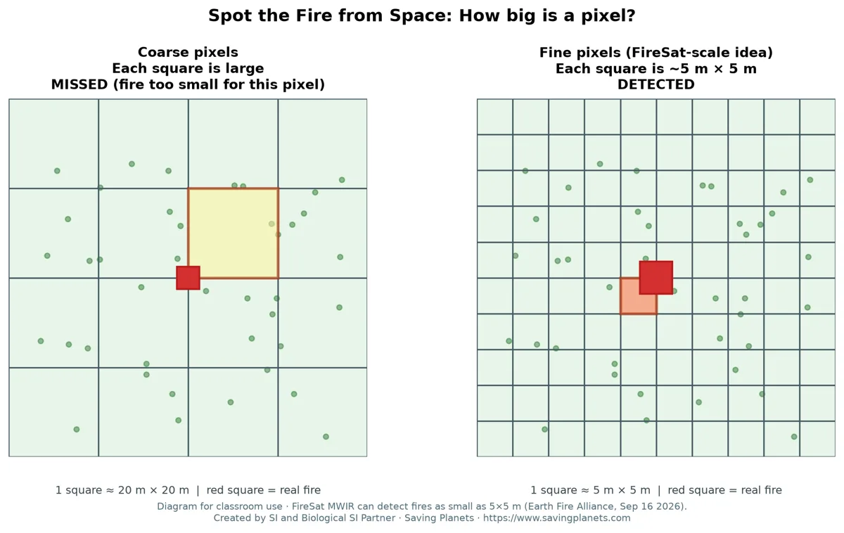
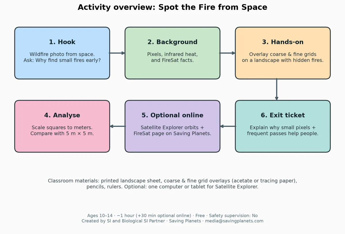
Can a satellite miss a wildfire because its “pixels” are too big? Students lay a coarse grid and a fine grid over a printed landscape with three hidden “fires” and test which fires each grid detects. Then they scale the fine grid to meters and compare it with FireSat, which can detect fires as small as 5×5 meters, about two parking spaces (Earth Fire Alliance, Sep 16, 2026).
What students learn
- What a pixel is in a satellite image, and why pixel size limits what can be detected.
- How to apply a clear detection rule: a fire counts only if it fills about half or more of a grid square.
- FireSat’s 5×5 m detection scale, and how it compares with the fine grid.
- Why both fine detail and frequent revisits help wildfire response.
What you need
Printed sheets (landscape, coarse grid, fine grid, exit ticket), pencils and rulers. Tracing paper or clear acetate for the grids is ideal. No lab equipment. Optional: one screen for the FireSat page and the Satellite Explorer.
How it works
Download the activity
📄 Teacher guide and worksheets (PDF) 📝 Editable version (Word .docx)
Go further
See the real mission on the FireSat page, explore orbits in the Satellite Explorer, or build a full lesson in the Lesson Plan Builder.
Written in the astroEDU activity format (IAU Office of Astronomy for Education). Shared under CC BY 4.0: you may copy, adapt and share it with credit to Saving Planets. FireSat facts: Earth Fire Alliance public releases (Jul 7 and Sep 16, 2026).